Tasmanian Wilderness Expedition 2004
- 30 days
- 2 Air-Drops
- River Crossings
- No Walking Tracks
- 300km Untouched Coastline
|
Chris Bray & Jasper Timm
|
All photographs on this webpage are � Copyright � Chris Bray. Do not distribute. Please contact Chris via Email contact@blackJackal.com for further information.
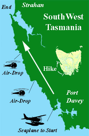
Map of hike - A seaplane from Strahan to Port Davey, then hike back to Strahan along the coast, resupplied at two locations by air. Approx 300km of winding coastline, with no walking tracks, campsites or anything - just untouched wilderness.
Just over 100 days of planning & organising.
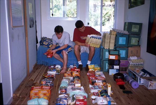
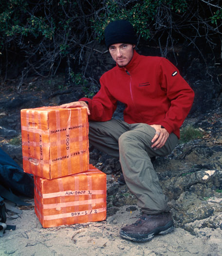
Packing food & supplies in Chris's room.
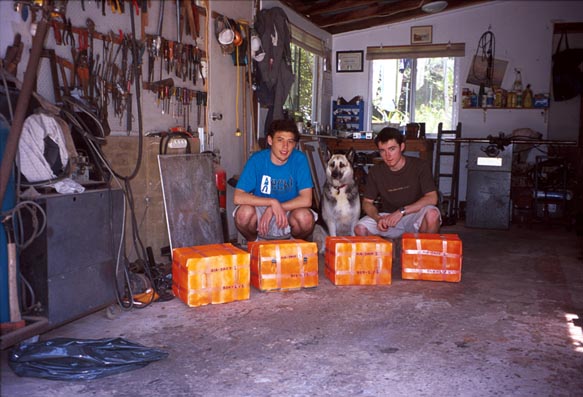
Jasper, Chris and Chris's dog with packed air-drops in garage.
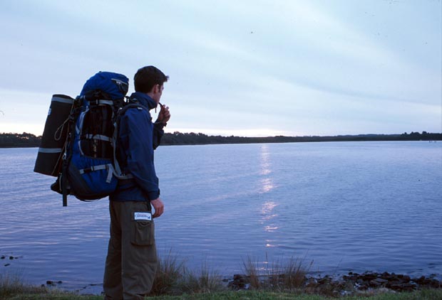
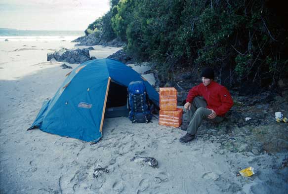
Chris in Strahan, Tasmania - the evening before setting off, sporting just over $7,000 worth of brand new hiking gear given to us by our sponsors.
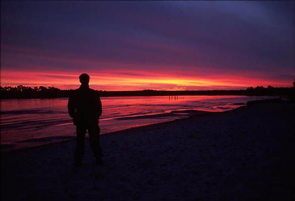
Chris silhouetted against sunset Strahan, Tasmania.
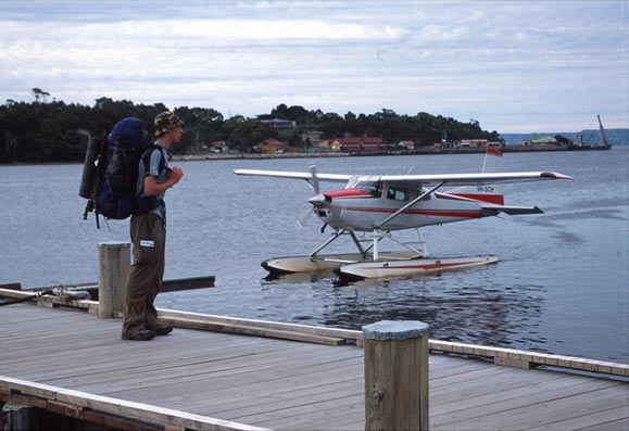
Our chartered seaplane taxis in to meet Jasper at the wharf to fly us to Port Davey.
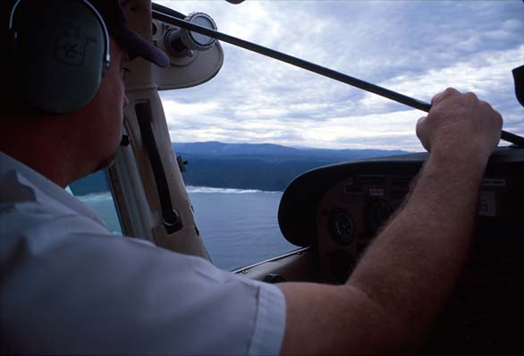
Our pilot, who has never flown to Port Davey before (has only done short local tourist scenic flights), fly�s us south to the start of our adventure.
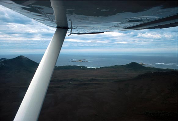
Chris's view looking out the co-pilot seat window.
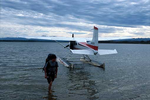
Chris wades ashore from seaplane - our last contact with civilisation for weeks.
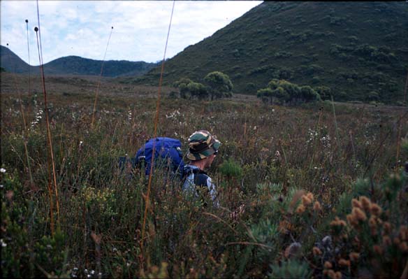
Jasper wading though waist high scrub - looked a lot shorter from the plane.
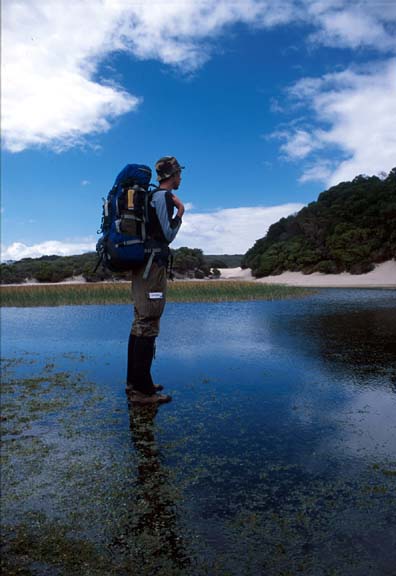
Jasper at Paradise Lagoon - clearly we have become so good at hiking we can now walk on water, which does save a lot of time.
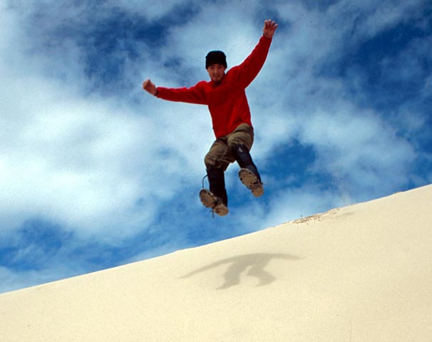
Chris leaping from atop a tall sand dune for no apparent reason. Good fun!
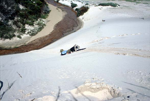
Chris sliding down a very steep sand dune, lying on brand new sponsored bed-roll.
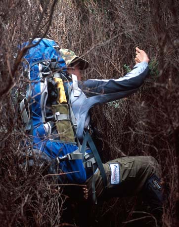
Chris fighting though unbelievably thick walls of dense scrub. Very slow, utterly exhausting work.
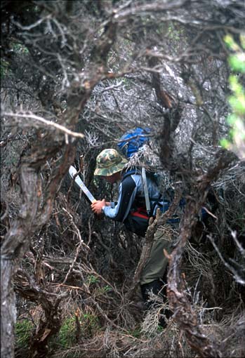
Chris hacking a path though dense Banksia tree scrub using machete.
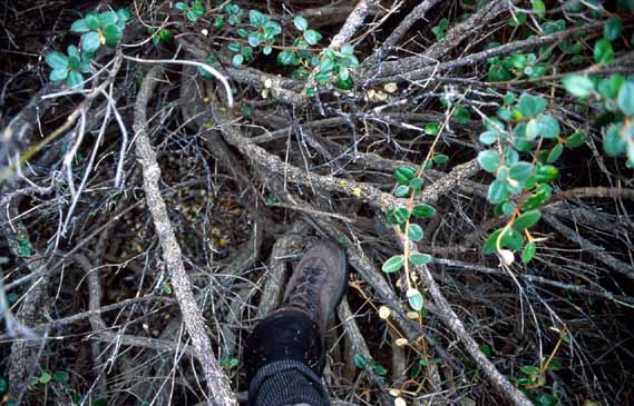
Some scrub was just too dense to fight though, so instead all we could do was flounder OVER the top in the branches, with our 25kg packs on. Note the actual ground, blurry, below.
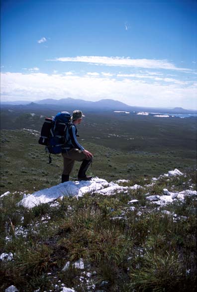
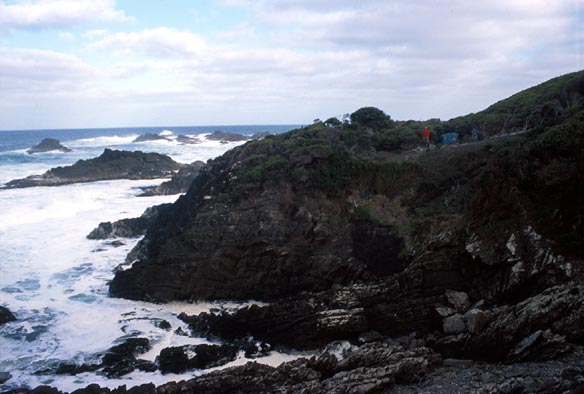
Chris, taking in the view before assessing best route towards next bay.
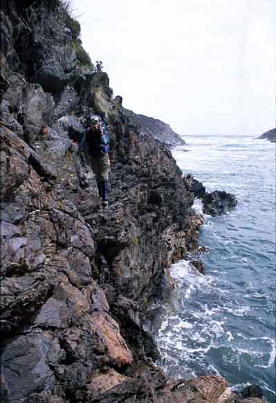
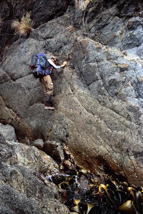
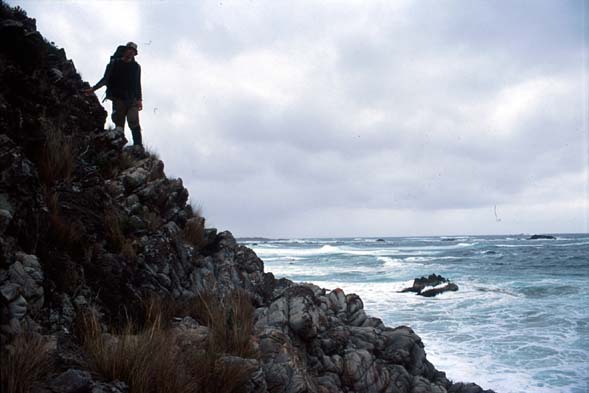
Jasper negotiating yet another unsettlingly sheer, loose rock faces that we had to edge around on many occasions.
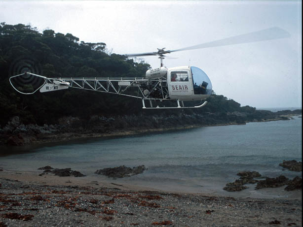
Helicopter coming to deliver Air-Drop #1 - came 1 day late, quite hungry.
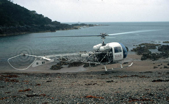
Helicopter trying to land in strong gusty winds to give us our supplies.
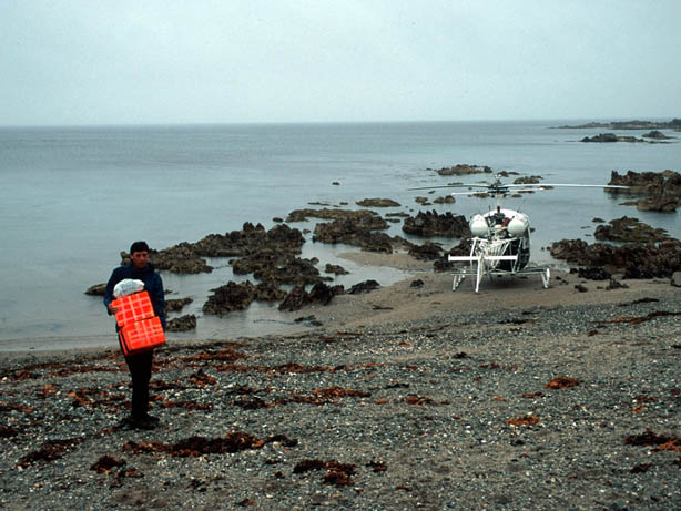
Jasper carrying Air-Drop packages up from landed helicopter.
Chris attempting to wash clothes in a small river.
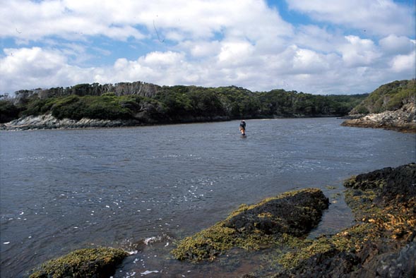
Jasper wading across a wide river. You can see one pack already safe on the far bank. Freezing cold.
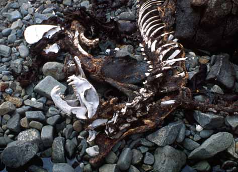
Skeleton of seal.
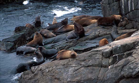
Australian Fur Seals. It was known that Australian Fur Seals had a haul-out point here at Point Hibbs, but we actually saw some little black pups, indicating that this was in fact a breeding colony. After speaking with experts at the CSIRO, it seems this is quite a discovery, as it was previously thought the only Australian Fur Seal breeding colonies on Earth were north of Tasmania, in a few specific places in Bass Strait. So Jasper and I discovered the worlds most southerly breeding colony of Australian Fur Seas, by several hundred km!
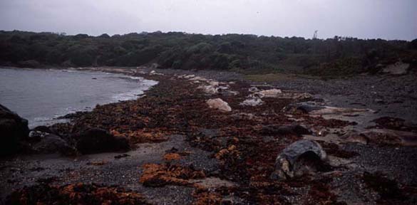
Decomposing bodies of over 100 whales that we smelt long before we came across. It was in fact the remains of 110 Long-Finned Pilot whales and 10 Bottle-Nosed Dolphins that stranded themselves, in a rare 'mixed-species stranding' back in November 2003, discovered many days after they had already died.
Chris with packages from Air-Drop #2.
Glad to have more food and supplies - Air-Drop #2
Tense moments - Jasper edging extremely carefully along vertical cliff face with 25kg pack on, trying desperately not to fall into the ocean below.
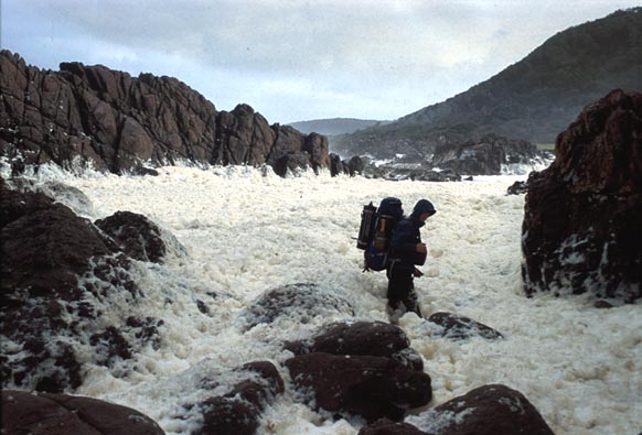
Chris amidst Sea Foam whipped up by massive storm - Unbelievable volume of foam, hiding deep rock-pools, boulders and holes. Slippery, smelly, deep and impassable. After several deep sections we abandoned this and wet up and around, taking good part of a day to get the far side. Insane.
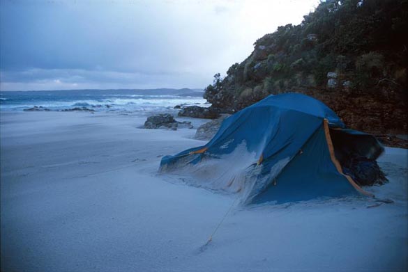
Tent - aluminium frame permanently bent overnight from howling wind building up sand on windward side. See tent door flapping & blurry. Sand blown so hard it stings.
Chris above rough seas, in very strong wind - note pack cover blown hard against shape of pack.
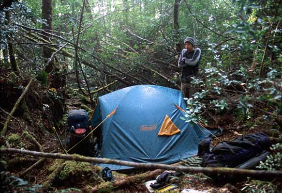
Insane campsite - See Jasper and tent perched upon headland. It was the best we could do.
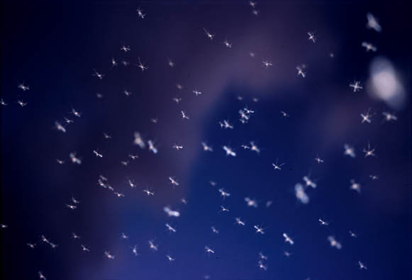
A random flash photo above Jasper's head at night - look at the number of mozzies!
Jasper hiking along coast.
Wading another icy-cold, wide river.
After a hours clearing / machete-ing the jungle we managed to cut out a campsite.
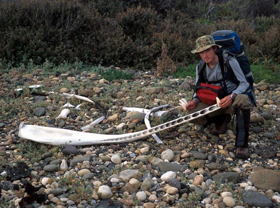
Chris with Sperm Whale jaw bone and some ivory whale teeth he found on isolated beach.
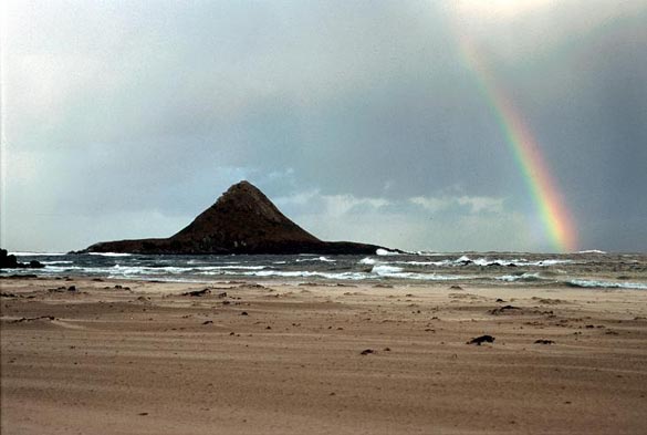
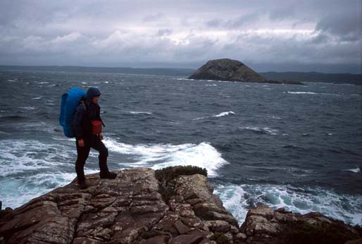
Aptly named 'Hibbs Pyramid' - an island near Point Hibbs.
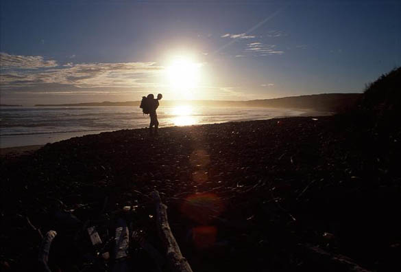
Hiking onwards late into the evening.
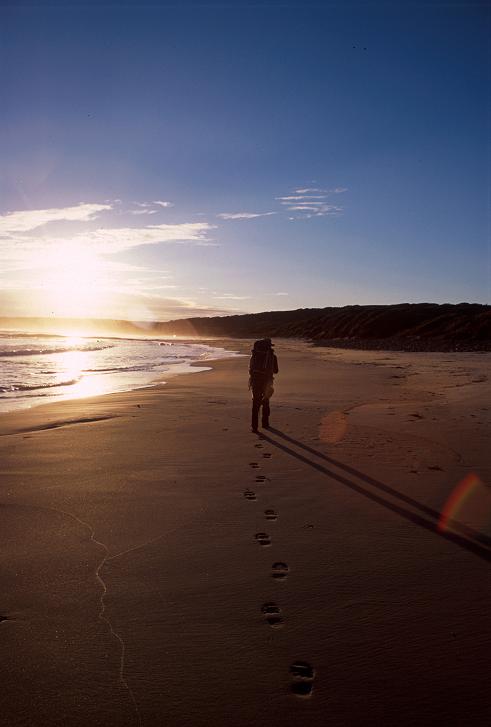
Easy hiking along pristine beach for many km.
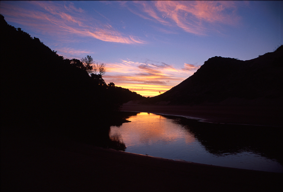
Sunset framed by hills at one of our river campsites.
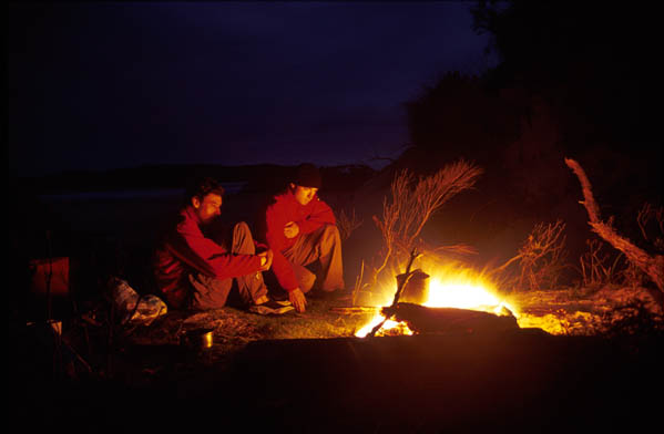
Crouching close to campfire for warmth.
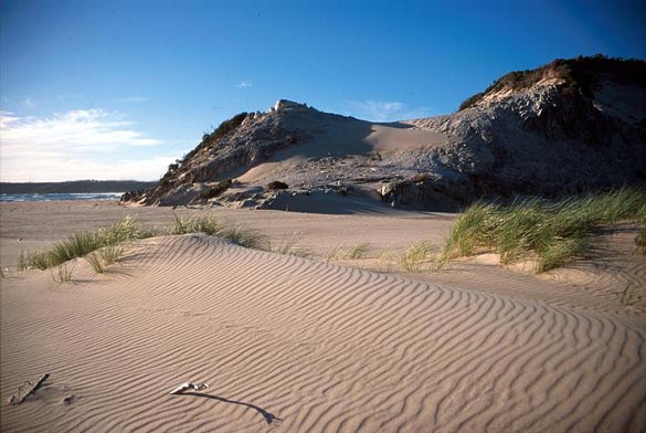
Senic wind-swept beach.
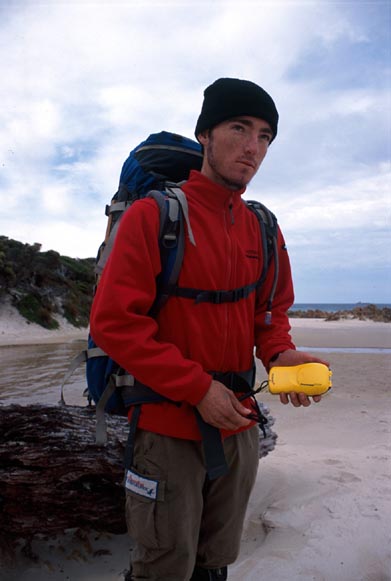
Chris not seriously about to use the EPRIB to call for help, just a promotional photo. =P
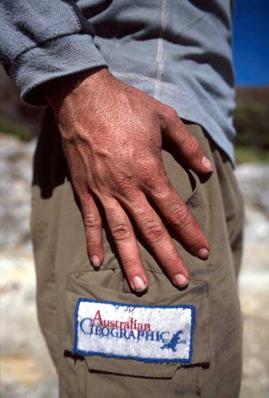
Close-up of Chris's hand - sunburnt, scratched, and thoroughly hiked-out, just like the tattered Australian Geographic stitched onto pants logo below.
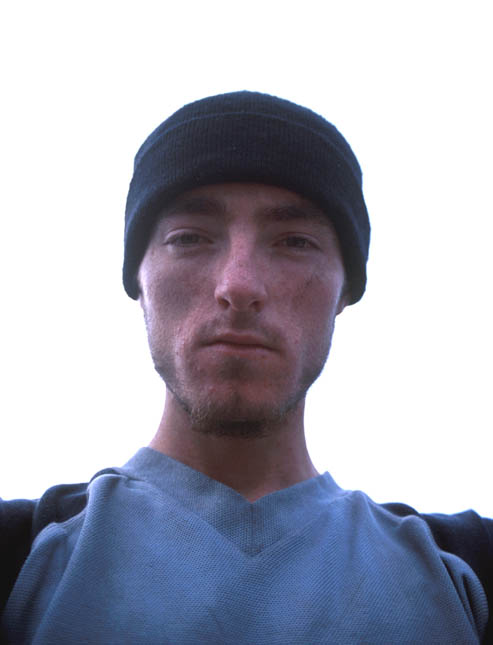
Just before taking a VERY LONG HOT SHOWER, back at Strahan. Note how sunken-in Chris's cheeks are - A month of intense exercise and being constantly hungry - and it starts to show.
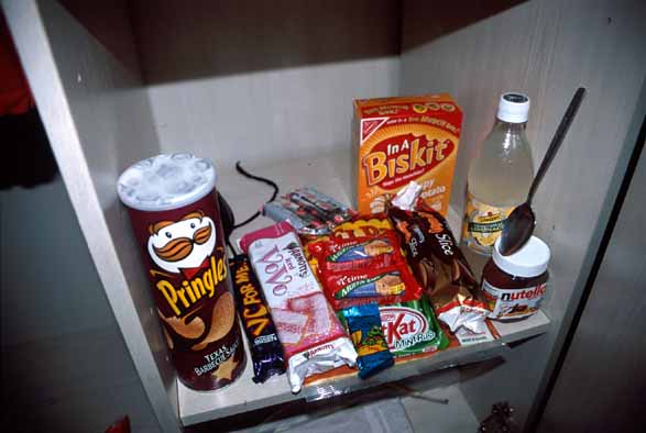
Healthy food - catching up on all the food we'd been dreaming about for weeks. This is inside our cupboard at a backpackers we stayed at while in Hobart.
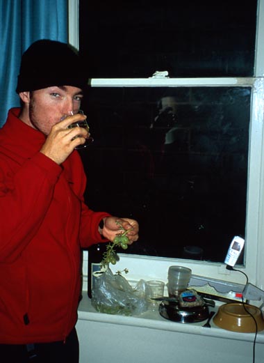
Yumm. Fine wine & cheese. Much tastier than brown river water and rice.
| |
|
|
 |
|